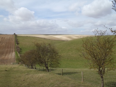
Some jottings from when me and Sue backpacked the Yorkshire Wolds Way (YWW) for six days in April 2013. We B&B’d for one night and camped the remaining nights. Apologies for the late posting – work and stuff get in the way sometimes!
This is not a step-by-step guide to walking the YWW – there are websites (such as the official National Trail – the latest version of the “YWW accommodation guide” from this site is very useful; and Walking Englishman – a great source of walks all over the country). We used the official trail guide “Yorkshire Wolds Way” by Roger Ratcliffe, published by Aurum) that give details of the route as well as things to see on the way. It would be nice for this to be spiral bound so it is easy to store in a pocket on the relevant page.
We travelled by train from South Devon (no problems on the forward or return journeys), but it was not obvious that we had to change at Brough (when travelling from Doncaster) to get a train that stopped at Hessle. It’s worth checking at Doncaster first!
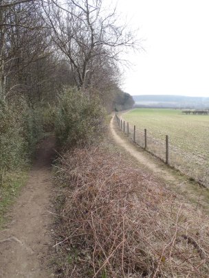
The YWW is very well waymarked with finger posts and National Trail acorn symbols. There are mileage posts, topped with an acorn, at intervals too (no excuse for not carrying a map and compass, though!). From Hessle, the YWW runs between the Humber and a railway line for the first couple of km. Part of the path was closed (the board stated from January to August 2013) for emergency repairs. With no alternative route posted, we scrambled past the temporary fencing, eventually to find a section of the wall retaining the railway embankment that had been washed away by the recent rains. The fencing closing off the other end did carry an alternative route (I think it was along the road to Hessle).
We planned this walk for mid-April, hoping to see Spring flowers and the Hawthorn hedges in blossom, plus we wanted to see the areas where David Hockney painted some of his large canvases.
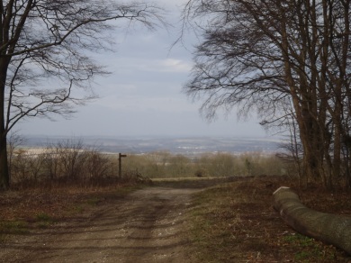
The cold winter and delayed Spring meant many flowers were absent. Although daffodils and snowdrops were out in places, the Hawthorn hedges were barely coming into bud. Crops in the fields had grown no more than a few centimetres and the trees remained skeletal, showing branches rather than masses of leaves. In general, the woodlands we passed through appeared very well managed. Our wild camp for the first night was close to a wooded area where we saw deer at dusk.
A little research showed there were few shops on the YWW and not every village has a pub. We relied on pub lunches every day (apart from the last day), which helps keep the pack weight down, but sets a pretty rigid timescale to the day. For evening meals while camping, we posted food parcels to each campsite. Each parcel contained a couple of Look What We Found pouches (great tasting pre-cooked meat courses – we reckon chill con carne is the best) ideal with Smash, noodles or rice. Our parcels also contained fruit cake, snacks and breakfast for the following day and teabags. We would have been hungry if any parcel had not been delivered!
We had a few hours sun on the first day and as we walked into Filey, otherwise white cloud dominated the days. Visibility to the horizon was limited at times by mist – we missed the panorama over the Vale of York. Over the first few days, there was a very cold Easterly wind, no problem as long as we kept moving. To remind us of the weather a few weeks earlier, there were piles of snow in the hedgerows. The wind shifted to the South-West for the remainder of the walk – although it remained chilly in the very strong winds; the high gusts with driven dust from the dry land made walking interesting at times.
We had an hour or two of rain on one day, with some rain at night.
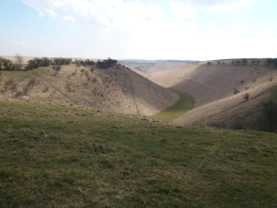
All-in-all, the weather could have been kinder. In the summer, though, the steeply sided dales would be sun traps.
Due to the well-drained land, natural water is very limited, with the older villages often located near springs.
In a few places (such as Sylvan Dale, near Millington, and Staxton Wold, South of the RAF base) the YWW has short, but very steep, ascents and descents. If the ground is wet or it is raining these slopes could be tricky, especially with a large or heavy pack. Our walking poles came in very useful in these places.
The YWW involves walking minor roads and farm tracks (maybe too many km on tarmac road and track?) as well as footpaths and bridleways. Kissing gates get you through most hedges and fences, there are very few stiles. However, at Wharram Percy medieval village, English Heritage have made their kissing gates on the YWW too small to pass through with a large pack!
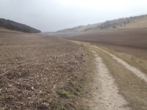
With the predominant chalk (geologically the Yorkshire Wolds are part of the same structure as the North and South Downs), the tracks can be very bright with lots of glare, so take polarising sunglasses if glare bothers you. At times on our walk, the reduced growth of the crops meant the chalk-white stones in the large fields looked like snow and what looked like smoke hanging over distant fields was dust whipped up by the drying winds.
In our area of South Devon, small fields with high and wide Devon hedges abound. Not so in the Yorkshire Wolds, where (to us) the fields seemed prairie-like in size and the hedges are one or two layers of Hawthorn. We saw a large number of Hares throughout the walk. It was delightful to watch them playing and chasing each other across a field.
We hardly saw other walkers on the YWW. There was an LDWA 50 mile walk over the weekend, though, which more than made up for this.
Overall, the YWW is an easy to walk route that is very well way-marked; maybe there are too many km on roads and farm tracks. The YWW is tranquil – we met a handful of walkers and did not meet anyone else walking the YWW. Apart from the first few km from Hessle and walking into Filey, the country-side is gently rolling with large fields and “big skies”. There are a few steep ascents and descents, where we had to take care walking with packs. The Dales are unusual with their steep sides and flat bottoms and the villages are small and delightful.
Our route:
Day 1: Hessle to outside South Cave where we wild camped.
We stopped for lunch in the Green Dragon, Welton.
Distance: 24 km
Day 2: Just outside South Cave to Manor Farm campsite, Goodmanham.
We stopped for lunch at the Gnu Inn, North Newbald. We can recommend the Goodmanham Arms pub/microbrewery.
Distance: 13 km
Day 3: Goodmanham to the Wolds Inn, Huggate where we B&B’d.
We stopped for a late lunch at the Rambler’s Rest, Millington (Millington also has the Gait Inn)
Distance: 21 km.
Day 4 Huggate to Hill Top Farm Camp site, North Grimston.
We stopped for lunch at the Cross Keys Inn, Thixendale.
Distance: 23 km
Day 5 North Grimston to Windlebeck Farm Campsite, Ganton.
We stopped for lunch at the cafe at Wolds Way Lavender, Wintringham.
Distance: 26 km
Day 6 Ganton to Filey. Brief lunch stop at the The Camp so we could get to Filey Brig campsite around 4pm.
We had an evening meal at the Bella Italia restaurant in Filey.
Distance: 23 km
Essentials of our kit:
My pack – Granite Gear AC Blaze AC 60 (see this review)
Sue’s pack – Osprey Sirrus 36
Shelter – MLD Trailstar and 2-man Oooknest (both excellent)
Poles – Fizan Compact walking poles
Sleeping bags – PHD Minim 500 (we needed these bags for the first few days!)
Stove – Primus Eta
Clothes: Kathmandu synthetic baselayer top, Montane Litepseed windshirt, Rab microfleece
Lidl leggings under Montane Terra pants
Montane Prism Primaloft jacket
Finisterre merino baselayer top and leggings

